Download presentation
Presentation is loading. Please wait.

1
World Geography Chapter 1: The Tools of Geography

2
Map Titles and Symbols Map Title: identifies the map’s main topic Example: Physical Features of Latin America Compass Rose: shows directions on a map Cardinal Directions: North, South, East, and West Intermediate Directions: Northwest, Northeast, Southeast, Southwest Map Legend/Key: a box or list on a map that identifies each symbol on a map and explains what it shows on the map

3
Map Grid Map Grid: system of imaginary lines to divide up space on their maps.

4
Map Scales Map Scale: tells you how to read the distances on the map – Example: 1 inch on a map might equal 10 miles on Earth.

5
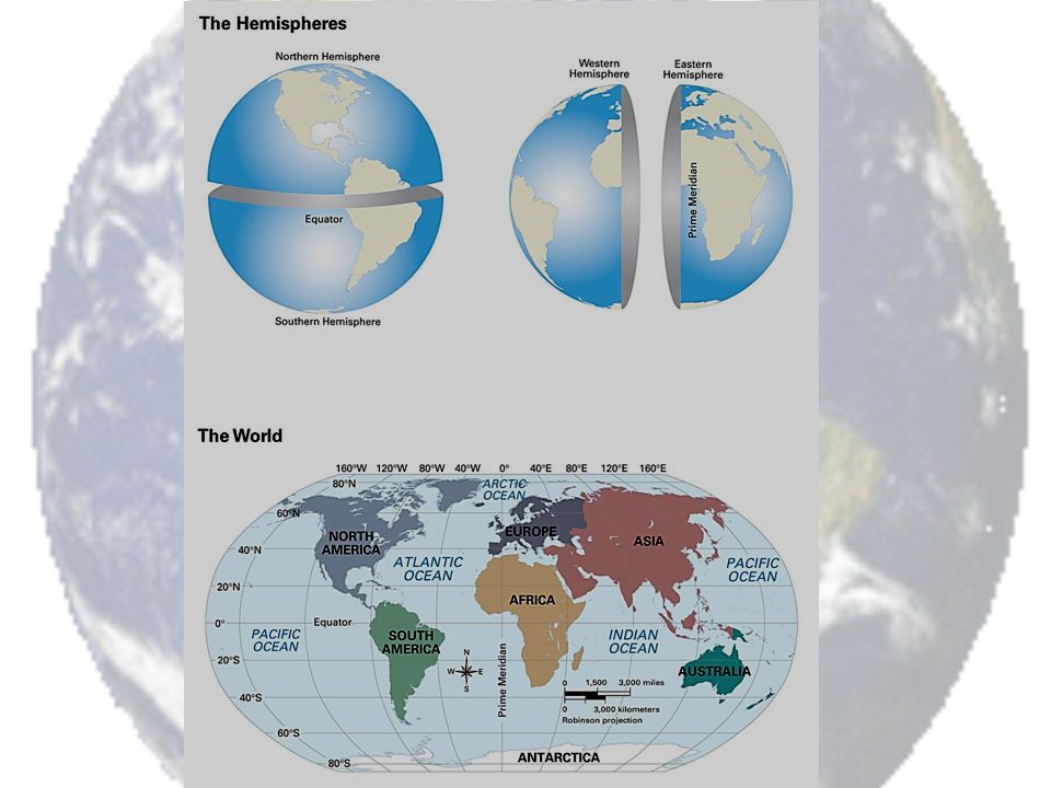
Hemispheres, Continents, and Oceans Hemisphere: half of a sphere. The Earth is divided by the equator into Northern and Southern hemispheres, and can be divided into Eastern and Western hemispheres by the prime meridian and international date line.

7
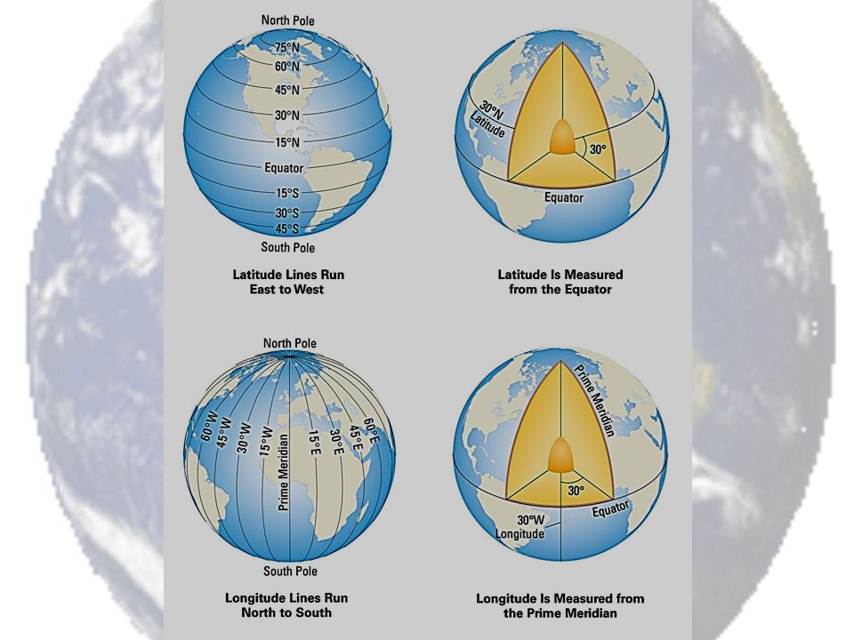
Latitude and Longitude (GLOBAL GRID) Parallels of Latitude: lines that run east and west around the globe, they are parallel (equal distance from one another). The most important line of latitude is the equator. Meridians of Longitude: half circles that run from the North Pole to the South Pole- Not parallel. Most important lines of longitude are the prime meridian and international date line.

10
Showing a Round World on a Flat Map Distortion: a change in the shape, size, or position of a place when it is shown on a map SEE PICTURE ON PAGE 13 FOR EXAMPLE OF DISTORTION

11
How do Geographers deal with Map Distortion? Map Projection: a way of representing the spherical Earth on a flat surface

Similar presentations