Download presentation
Presentation is loading. Please wait.

1
The World of Geography

2
What is Geography? Geo means= Earth Graphy = Field of Study * It is the study of our earth; our home. OR *Anything that can be mapped!

3
*Geography mixes up the physical and human aspects of our world into one field of study. *Geography shows the relationship between people and the environment.

4
What is a geographer? Someone who analyzes the Earth from many points of view. Someone who analyzes the Earth from many points of view.

5
We all develop our lifestyles, customs and cultures in response to the topography and geography of the space in which we live. Why does geography matter?!

6
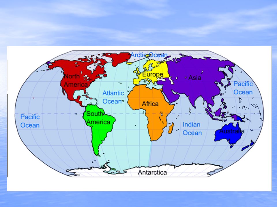
The Hemispheres

7
How Latitude and Longitude Form the Global Grid

8
The Geographer’s Tools Globes and Maps: Globes and Maps: –As people explored the Earth, they collected information about it. –Mapmakers wanted to present this information correctly. –The best way was to put it on a globe, a round ball that represented the Earth.

9
OwlTeacher.com –Because globes are not practical or easy to use to carry, flat maps were invented. –However, the earth is round and a map is flat. –Mapmakers had to find ways to make maps accurate.

10
Globes and Maps The most accurate way to present information on the islands, continents, and bodies of water of the world is to put it all on a globe, a round ball like the Earth itself. The most accurate way to present information on the islands, continents, and bodies of water of the world is to put it all on a globe, a round ball like the Earth itself. The only difference between a globe and the Earth itself is the scale, or size, represented on the globe. The only difference between a globe and the Earth itself is the scale, or size, represented on the globe.

11
Globes have a disadvantage: They cannot be complete enough to be useful and at the same time be small enough to be convenient. Globes have a disadvantage: They cannot be complete enough to be useful and at the same time be small enough to be convenient. Therefore, people invented flat maps. Therefore, people invented flat maps.

12
Maps try to show the Earth, which is round, on a flat surface. Maps try to show the Earth, which is round, on a flat surface. This causes distortion, or a change in accuracy of the shapes and distances of places. This causes distortion, or a change in accuracy of the shapes and distances of places. It is impossible to show the Earth on a flat surface without some distortion. It is impossible to show the Earth on a flat surface without some distortion.

13
In 1569, a geographer named Gerardus Mercator created a flat map to help sailors navigate long journeys across the globe. The Mercator projection, or method of putting a map of the Earth onto a flat piece of paper, is used by nearly all deep-sea navigators. The Mercator projection is a conformal map, meaning that it shows correct shapes, but not true distances or sizes. There are many types of other projections of the globe. Getting It All On the Map The World: Mercator Projection

14
There are many ways to show a globe on a flat map. The interrupted projection map, on the left, shows real sizes and shapes of continents. The equal area map, below left, shows size accurately. The Peters projection, below, shows land and oceans areas and correct directions accurately The World: Three Projections Interrupted Projection Equal-Area Projection Peters Projection

15
The World: A Robinson Projection ARCTIC OCEAN

16
Title (Subject of Map) Title (Subject of Map) Compass Rose (Directional Indicator) Compass Rose (Directional Indicator) Bar Scale (Gives distance in miles/km) Bar Scale (Gives distance in miles/km) Legend (Key of symbols used on map) Legend (Key of symbols used on map) Locator Map (Where in the world the map is located). Locator Map (Where in the world the map is located). Reading a Map
. Reading a Map.")
17
The Parts of a Map Compass Rose A compass rose is a model of a compass. It tells the cardinal directions, which are north, south, east, and west. A compass rose is a model of a compass. It tells the cardinal directions, which are north, south, east, and west.Scale The scale on a map tells you the relative distance on the map to the real world. For example, a map’s scale may tell you that one inch on the map equals one mile in the real world. The scale on a map tells you the relative distance on the map to the real world. For example, a map’s scale may tell you that one inch on the map equals one mile in the real world.

18
Key The key, or legend, on a map explains what the symbols on a map represent, such as triangles representing trees. The key, or legend, on a map explains what the symbols on a map represent, such as triangles representing trees.Grids Some maps use a grid of parallels and meridians. On a map of a small area, letters and numbers are often used to help you find your location. Some maps use a grid of parallels and meridians. On a map of a small area, letters and numbers are often used to help you find your location.

19
Political Maps Borders Capitals Cities

20
Physical Maps Mountains Deserts Plains Bodies of Water

21
Special Purposes Maps ClimatePopulationResourcesEconomicRoads

22
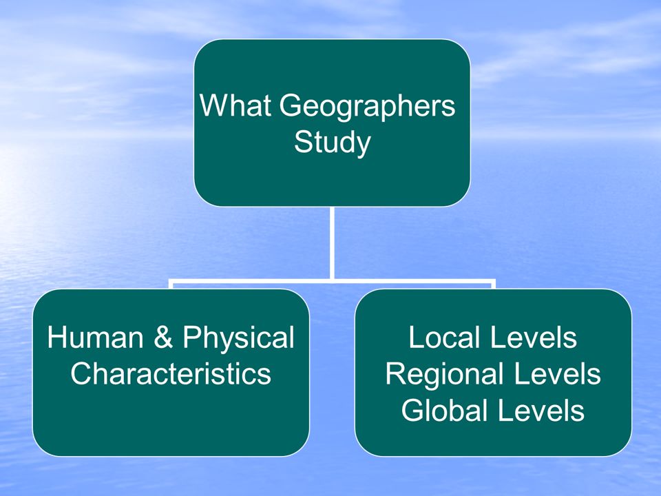
The Five Themes of Geography There are five ways to look at the earth There are five ways to look at the earth When geographers work, they are guided by two basic questions: When geographers work, they are guided by two basic questions: 1)Where are things located? 2)Why are they there? To find these answers, geographers use five themes to organize information
Why are they there. To find these answers, geographers use five themes to organize information.")
23
Things that geographers study: oceans oceans plant life plant life landforms landforms people people how the Earth and its people affect each other how the Earth and its people affect each other

24
The Five Themes: 1) Location – Geographers begin to study a place by finding where it is, or its location. An absolute location is a latitude and longitude (a global location) or a street address (local location). An absolute location is a latitude and longitude (a global location) or a street address (local location). Relative locations are described by landmarks, time, direction or distance from one place to another and may associate a particular place with another. Relative locations are described by landmarks, time, direction or distance from one place to another and may associate a particular place with another.
 or a street address (local location). An absolute location is a latitude and longitude (a global location) or a street address (local location). Relative locations are described by landmarks, time, direction or distance from one place to another and may associate a particular place with another. Relative locations are described by landmarks, time, direction or distance from one place to another and may associate a particular place with another..")
25
2) Place – Geographers study the physical and human features of a location. The image people have of a place is based on their experiences, both intellectual and emotional. People's descriptions of a place reveal their values, attitudes, and perceptions. The image people have of a place is based on their experiences, both intellectual and emotional. People's descriptions of a place reveal their values, attitudes, and perceptions. How is your hometown connected to other places? What are the human and physical characteristics of Factoryville? How do these shape our lives? How is your hometown connected to other places? What are the human and physical characteristics of Factoryville? How do these shape our lives?

26
3) Human-Environment Interaction – Geographers study how people affect or shape physical characteristics of their natural surroundings and how does their surroundings (environment) affect them?
 Human-Environment Interaction – Geographers study how people affect or shape physical characteristics of their natural surroundings and how does their surroundings (environment) affect them")
27
4) Movement – Helps explain how people, goods, and ideas get from one place to another. How do we depend on people in other places? How would our lives change if our movement options changed? What would happen if we traveled by camel or horse? How do we move from place to place? How do we actually get food?

28
5) Regions – Geographers compare the climate, land, population, or history of one place to another.
 Regions – Geographers compare the climate, land, population, or history of one place to another.")
30
Physical Geography Physical Geography Human Geography Human Geography Other fields of Geography: Other fields of Geography: Cartography, Hydrology, Meteorology, Economic, Urban Branches of Geography

31
Seek the causes of various land formations such as mountains, rivers, climates and weather patterns. Seek the causes of various land formations such as mountains, rivers, climates and weather patterns. To do this they take detailed measurements and keep careful records of formations. To do this they take detailed measurements and keep careful records of formations. Learning how earth works can help us predict things such as volcano eruptions and storms, helping humans prepare for or avoid disasters. Learning how earth works can help us predict things such as volcano eruptions and storms, helping humans prepare for or avoid disasters. Physical Geography

32
Human Geography Study the earth’s humans, past & present. Study the earth’s humans, past & present. Study why people live where they live, work where they work, eat what they eat. Study why people live where they live, work where they work, eat what they eat. Because people are so diverse, human geographers often specialize. They may study only Africa or only people in urban areas. Because people are so diverse, human geographers often specialize. They may study only Africa or only people in urban areas. Study people’s common needs such as food, shelter, clothing and how people meet these needs. Study people’s common needs such as food, shelter, clothing and how people meet these needs. Also study people’s affect on the world and environment. Also study people’s affect on the world and environment.

33
Cartography: the science of making maps Cartography: the science of making maps Hydrology: the study of water on earth; including rivers systems and rainfall patterns. Hydrology: the study of water on earth; including rivers systems and rainfall patterns. Meteorology: the study of weather and what causes it. Meteorology: the study of weather and what causes it. Other Fields of Geography

Similar presentations