Download presentation
Presentation is loading. Please wait.

1
How many hemispheres can this map be divided into?
Bell Ringer How many hemispheres can this map be divided into?

2
Unit 2 Studying Geography

3
GQ: What methods do geographers use to show the Earth’s surface?

4
1. Displaying the Earth’s Surface
Early models of the Earth were flat Sailors proved it was round Globes – spherical models of the Earth Most accurate size, shape, distance, direction Hard to carry

5
Maps – flat drawings of all or parts of the Earth
Show small areas in great detail Show specific information Can’t show accurate size, shape, distance, direction together Easy to carry Reflect: Describe how an explorer could set sail thinking the Earth was flat and return knowing it was round.

6
Hemispheres – “half spheres”
Equator – circles the middle of the Earth Divides Northern and Southern hemispheres Prime Meridian – runs pole to pole Divides Eastern and Western hemispheres

7
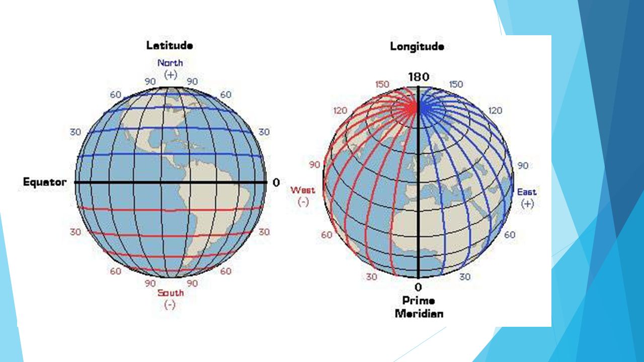
Finding Location Grid system – imaginary lines on maps and globes
Latitude – parallel to Equator Measure distance in degrees north or south Longitude – parallel to Prime Meridian Measure distance in degrees east or west Absolute location – exact spot where latitude and longitude lines meet

9
Projections – ways of showing the Earth on a flat sheet of paper
Each map projection shows the Earth in a different way Choose which one to use depending on goals

10
Bell Ringer How can different types of weather systems affect the Earth’s surface over time?

11
Chapter 2 Lesson 2

12
GQ: How do geographers use the five themes and six essential elements of geography?

13
Five Themes of Geography
Theme – a topic that connects ideas Location Place Human-Environment Interaction Movement Regions

14
2. Six Essential Elements
The World In Spatial Terms Studies where a certain place is located Raises awareness of the world around you Places and Regions Describes: Natural features – weather, animals, landforms Human features – language, way of life

15
Physical Systems Human Systems
Analyzes how weather systems shape Earth’s surface Volcanoes, glaciers, hurricanes Studies how plants and animals depend on each other for survival Human Systems Why humans choose to settle in certain places How they move and exchange goods or ideas

16
Environment and Society
How the environment affects way of life How humans affect the environment Uses of Geography Helps understand how people, places, and environments interact with each other Reflect: How would living far from a water source affect the way a community lives?

17
GQ: What are some key ways that maps are used?

18
3. Types of Maps Physical Maps – show land and water features
Use colors to show different features Has a key to explain each color Political Maps – show names and borders of countries Location of cities and other man made features Also show physical features

19
Examples: Special Purpose Maps – show specific kinds of information
climate natural resources roads population historical information Reflect: Draw a special purpose road map of your surrounding neighborhood.

20
How To Read Maps Map Key – explains information shown on the map
symbols, lines, and colors Map Scale – measuring line that shows distance represented Helps calculate distance between points on the map Cardinal Directions North, South, East, West

Similar presentations